APJ ABDUL KALAM TECHNOLOGICAL UNIVERSITY Previous Years Question Paper & Answer
Semester : SEMESTER 5
Subject : Geomatics
Year : 2017
Term : DECEMBER
Branch : CIVIL ENGINEERING
Scheme : 2015 Full Time
Course Code : CE 307
Page:18
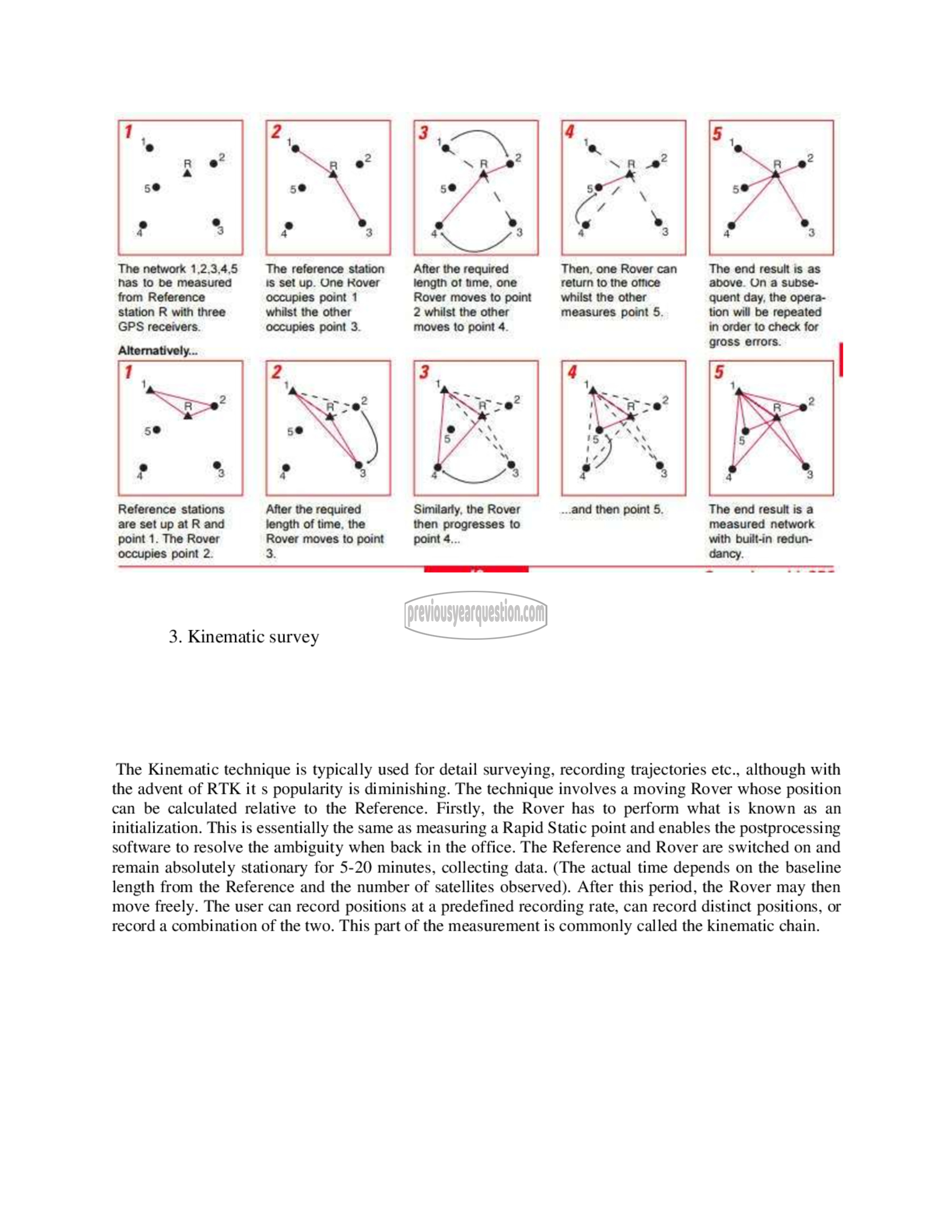
The end result is as
above. On a subse-
quent day, the opera-
After the required
length ೦1 ime, one
Rover moves to point
2 whilst the other tion will be repeated
moves to point 4. in order to check for
gross errors. |
After the required
length of time, the
Rover moves to point
3.
3. Kinematic survey
The Kinematic technique is typically used for detail surveying, recording trajectories etc., although with
the advent of RTK it s popularity is diminishing. The technique involves a moving Rover whose position
can be calculated relative to the Reference. Firstly, the Rover has to perform what is known as an
initialization. This is essentially the same as measuring a Rapid Static point and enables the postprocessing
software to resolve the ambiguity when back in the office. The Reference and Rover are switched on and
remain absolutely stationary for 5-20 minutes, collecting data. (The actual time depends on the baseline
length from the Reference and the number of satellites observed). After this period, the Rover may then
move freely. The user can record positions at a predefined recording rate, can record distinct positions, or
record a combination of the two. This part of the measurement is commonly called the kinematic chain.
